
Detailed satellite images of Dimona nuclear facility are free-to-access thanks to a Trump-era change in regulations.
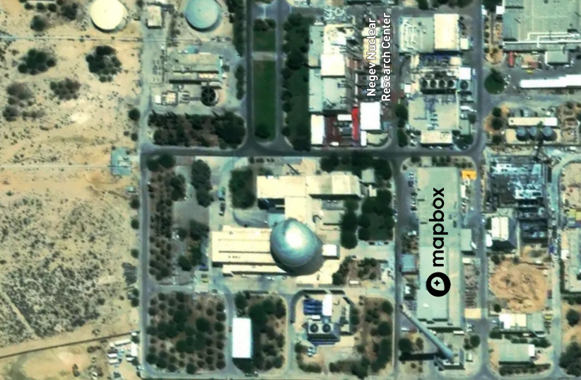
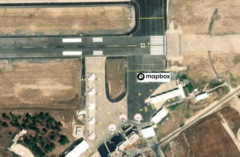
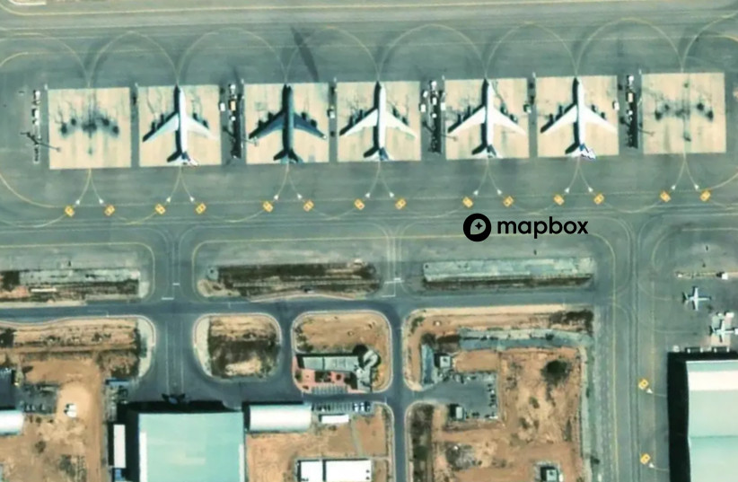
Detailed satellite imagery of the Dimona nuclear facility and fighter jets at Israeli bases can now be accessed for free online, thanks to a change in satellite imagery regulations implemented under the Trump administration last year.
The imagery can be accessed on the Mapbox application, a free-to-access website that provides custom online maps for websites and applications.
Mapbox announced on Tuesday that it had quadrupled the resolution it offers for imagery of Israel and the Palestinian territories. The company stated that the newly available imagery could be used to “plan a hike, check a delivery or navigate between cities.”
The company worked with its imagery partner Maxar to provide the updated imagery of Israel and the areas around it. The new imagery was collected in the summer of 2021 and can be used with Mapbox GLJS v2 to provide a 3D perspective in great detail.
Satellite imagery of Israel is regulated in the United States by the Kyl-Bingaman Amendment, which requires that licenses for the collection or dissemination of satellite imagery of Israel by non-Federal entities only be issued if the imagery is “no more detailed or precise than satellite imagery of Israel that is available from commercial sources.”
The amendment had been implemented in order to prevent Israel’s enemies from using imagery from the public domain to spy on its sensitive sites.
The highest resolution allowed had been 2 meters Ground Sample Distance (meaning only objects 2 meters and larger could be seen), but in July 2020 the US Commercial Remote Sensing Regulatory Affairs Office decided to change the limit to 0.4 meters Ground Sample Distance, allowing for much more detailed and clear satellite imagery.
At the time when the regulation change was implemented, Amnon Harari, head of the Defense Ministry’s Space and Satellite Administration, told KAN Reshet Bet radio that he “didn’t think” that the Americans had asked Israel before implementing the change.
Harari stated that he believed that the decision was made due to pressure from bodies in the satellite imagery industry who wanted to remove the regulations in order to get more business outside the US.
“Of course we would have preferred a situation in which the resolution which satellites of foreign nations see would be such that would protect us. It’s always better that they see you blurred than see you clearly,” said Harari.
“We always prefer to be photographed at the lowest resolution possible.”
The new publicly-available imagery provided by Mapbox comes after satellite images of the Dimona nuclear facility was released in February by the International Panel on Fissile Material (IPFM) showing that construction work was underway for a major expansion. The images released by IPFM were collected after the change in regulation.
As reported by The Jerusalem Post