
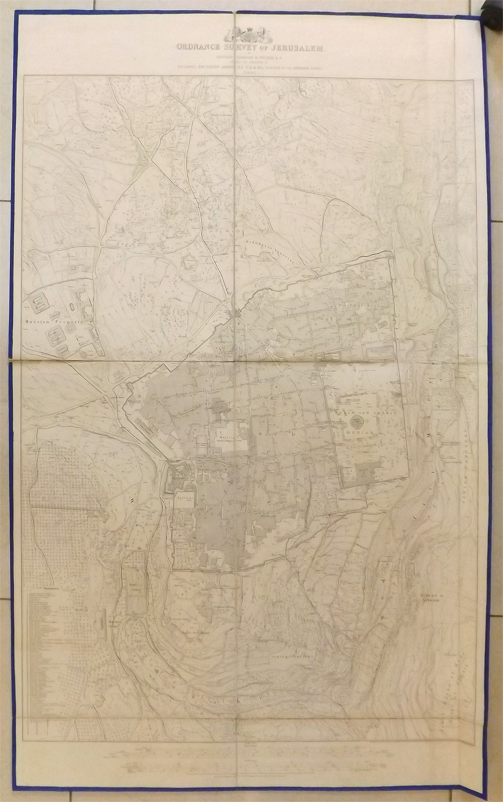
The maps were drawn by British engineer Captain Charles Wilson and published in 1865; this was the first modern archaeological, cartographic survey conducted in Israel.
The heirs of a deceased collector of rare maps recently came to the Kedem auction house in Jerusalem to sell some of the items that belong to his estate, including a unique collection of maps that were drawn 150 years ago, containing the first modern topographic maps of Jerusalem.
The maps, offered at a starting price of about NIS 2,700, were finally sold for NIS 13,000.
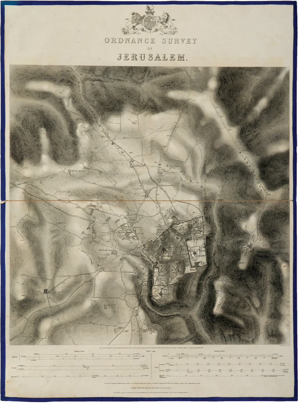
The survey was conducted by Captain Charles Wilson, a well known British army engineer sent to Jerusalem to help the Ottomans with handling sewage and sanitation problems. The maps are the result of a year of research using relatively advanced technology. Wilson, who is considered one of the pioneers of the research of modern Israel and one of the heads of the Palestine Exploration Fund, began, upon his arrival in 1864, to map the city, using the latest knowledge and latest technological tools at the time.
For a whole year Wilson made cartographic surveys of the city, and he began to thoroughly map, among other things, the streets of the Old City of Jerusalem.
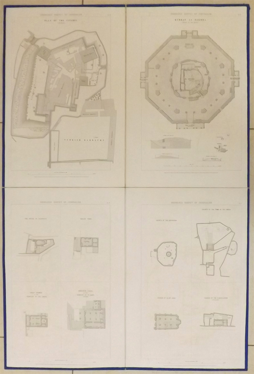
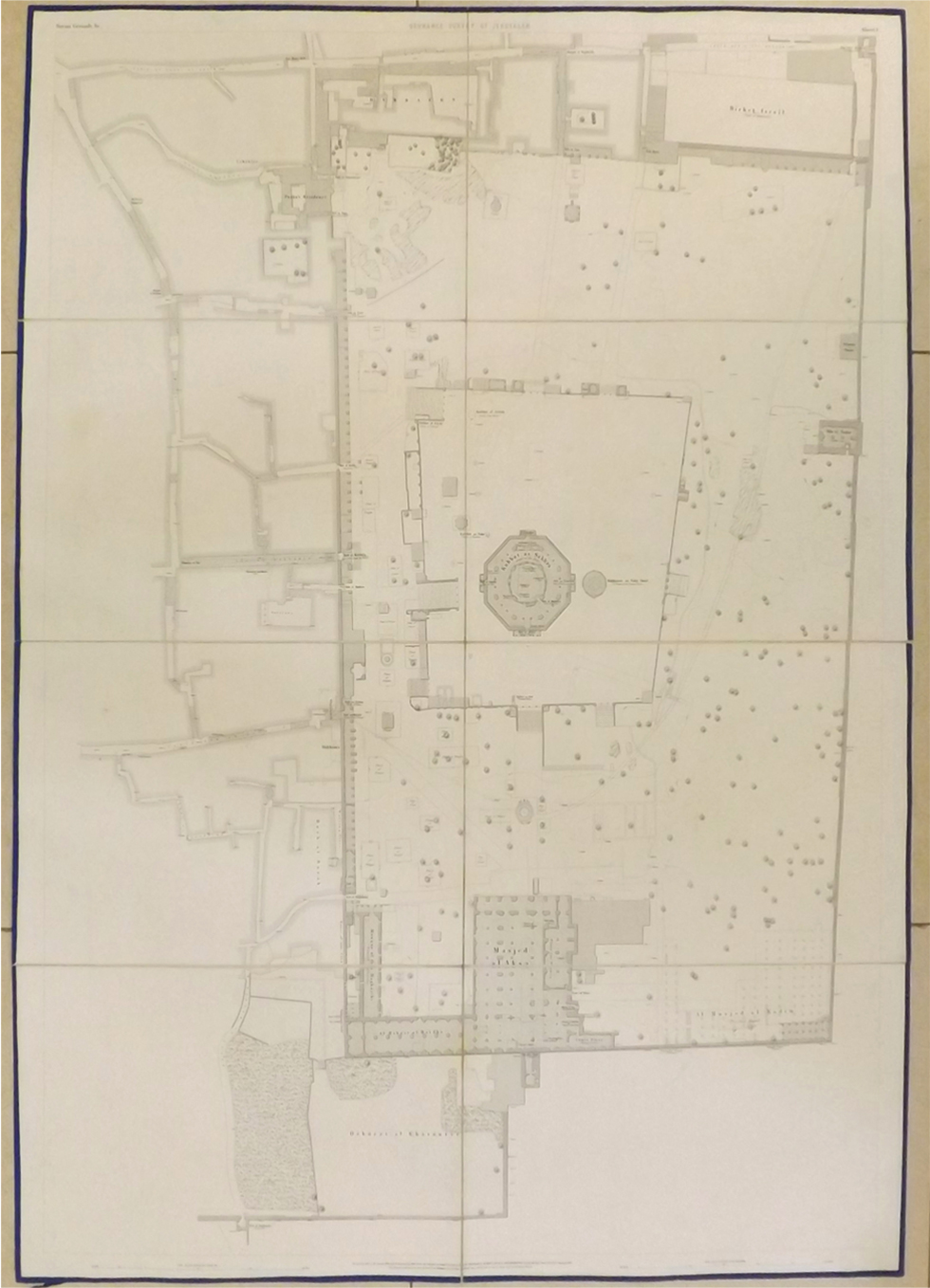
Wilson also began archaeological excavations around the Temple Mount. He helped excavate and map the various archaeological findings in the vicinity of the Temple Mount and inside it, including the ancient and famous structure, Wilson’s Arch, named after him.
At the end of the process, Wilson organized all his findings into the first modern topographical survey of Jerusalem, published in 1865.
The survey includes the first cartographic maps of Jerusalem’s Old City, the Temple Mount, the Dome of the Rock and the Church of the Holy Sepulcher.
The city maps, which were drawn as part of the tour of the British military envoy to Israel, were bound together into a “survey of Jerusalem”, which is essentially the first modern archaeological cartographic survey first conducted in Israel, which served scholars and additional researchers for many years.
“The survey is an unusual item, because he actually undertook the first practical survey ever conducted in the city of Jerusalem. Until then, it was customary in Europe to draw Jerusalem according to imagination and as the city is described in various scriptures. This map is the basis for the modern understanding and recognition of the city of Jerusalem, which had been, up until that time, shrouded in mystery,” explained Meron Eren, one of the heads of the Kedem auction house.
As reported by Ynetnews