
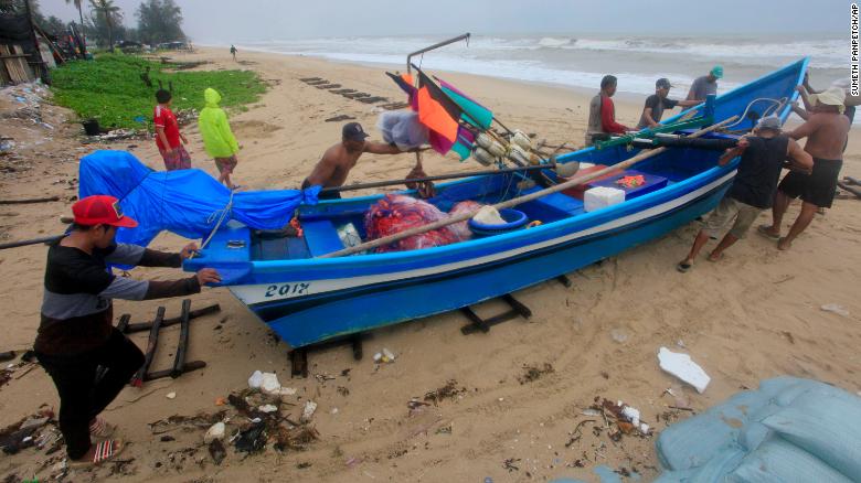
Bangkok – Thousands of people are fleeing Thai islands popular with tourists ahead of what could be the most devastating storm to hit in decades, officials told CNN on Thursday.
Tropical Storm Pabuk is expected to make landfall about 7 p.m. local time Friday (5 a.m. ET) near the Chumphon archipelago, on the eastern border of Thailand’s Surat Thani and Nakhon Si Thammarat provinces, but heavy rain has already arrived.
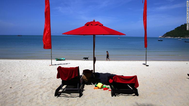
Tourist hotspots in the Gulf of Thailand, including Koh Samui, Koh Phangan and Koh Tao islands, along with islands in the Andaman Sea such as Phuket and Koh Phi Phi — made famous by the movie “The Beach” — are expected to be affected by the storm.
“We are still compiling the number of evacuees. I can say several thousand people for over 16 provinces,” government spokesman Putthipong Punnakanta told CNN by phone.
“It is high season, there are many foreign tourists at popular destinations. We have informed them in advance since two days ago. I would say most of them have left islands and come to the mainland.”
Phuwieng Prakhammintara, director general of Thailand’s Meteorological Department, told CNN the storm could cause waves as high as seven meters (22 feet), but that waves were more likely to reach 3 to 5 meters in height.
Schools in coastal areas are to be closed and Thailand’s armed forces are on standby for Pabuk’s arrival.
Bangkok Airways announced the cancellation of all flights to and from Koh Samui on Friday “for safety reasons.” Affected passengers will be able to rebook their flights without paying fees or charges, the airline said.
After crossing the Chumphon Archipelago the storm will, if the current track holds, make a second landfall over Surat Thani province early Saturday.
Tracking Pabuk
Pabuk will then move over the Malay Peninsula towards the Andaman Sea relatively quickly, but not before dumping large amounts of rain across the region.
The storm is expected to bring strong winds, high waves and surf along with surge, and heavy rain with flooding. While the winds, surf and surge will be dangerous especially, to an area not used to seeing these types of storms, the most significant danger is the rain and flood potential.
Areas in the southernmost portion of Thailand could receive well over 250mm of rain. There is also the possibility of mudslides from the Phuket mountain range on the western side of the peninsula.
It is highly unusual for tropical storms and typhoons to make landfall in Thailand. The last time a tropical storm made landfall in Thailand was in 1962, when Tropical Storm Harriet impacted 12 provinces and claimed 900 lives. The only typhoon ever to make landfall in the Southeast Asian nation was Typhoon Gay in 1989.
The province likely to be worst affected is Nakhon Si Thammarat, where Harriet hit.
As the storm progresses out to the Andaman Sea and towards the Bay of Bengal into next week it could become a problem for the coasts of Myanmar, Bangladesh or India.
As reported by CNN